Where are the uninsured located in Texas? Part 2: By census tract
This the second part in a data analysis series on Texas’ uninsured, with the focus this time on census tract data.
Texas continues to lead the nation with 16.4% of its population without health insurance. In Part 1 of this series, we looked at county-level trends in the uninsured and where they live. We found that the largest number of the uninsured live in densely populated cities such as Houston, Dallas, Fort Worth, San Antonio and others. But rural counties have the largest percentage of their population who are uninsured, which should not be ignored when considering the demographics of individuals who need health coverage.
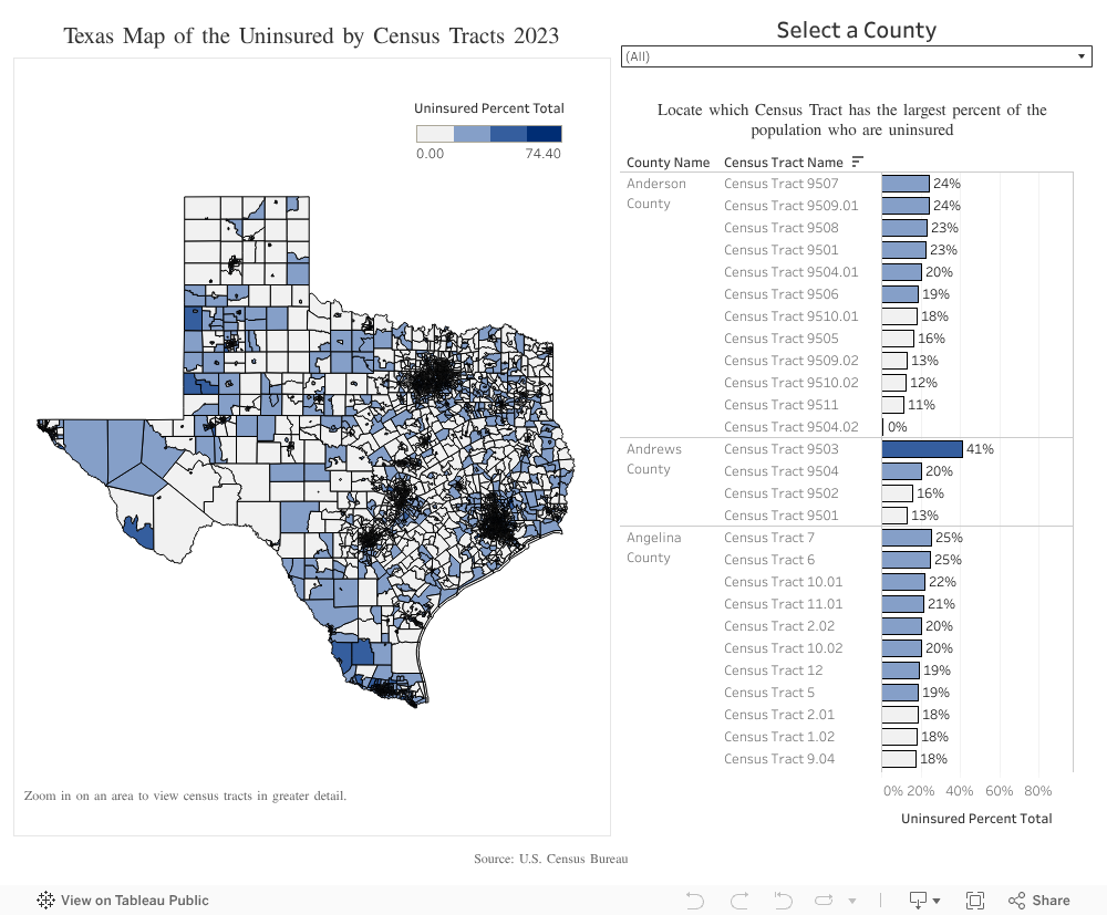
Although relevant, county-level data does not always give clear insights into what is happening at the neighborhood level. To do this, we zoomed into census tracts — small geographic areas that fit inside counties.
Why look at census tract data?
To better understand what a census tract is, think of them as puzzle pieces that make up a county. Each tract usually contains 2,500 to 8,000 people. Census tracts are smaller and more uniform in population size than ZIP codes or counties. As such, they help health officials, policymakers and researchers to:
- Identify neighborhood trends
- Understand community needs
- Recognize local patterns that can be easily overlooked
This level of detail is crucial for making targeted, effective decisions to close gaps in health coverage and improve access to care across Texas.
By visualizing the data at the census tract level, we can better inform policy discussions, local outreach efforts and funding strategies. Solutions to increase health coverage enrollment in targeted areas will be most effective when rooted in an understanding of where Texans are who need them most.
Explore the map to see how your community compares and why closing these coverage gaps is essential for a healthier Texas.